New FishCast subscriptions are unavailable while Optimal Catch Locations are being updated with great new tech!
Check back for updates!
FIND FISH FASTER with FishCast™
WHAT FishCast™ OFFERS
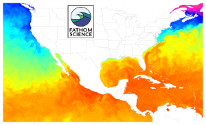
Sea Surface Temperature
click image for larger view
Helps you choose the best spots to find fish. Our SST maps provide water temperature information for today, tomorrow, and the next day, from Gulf Stream location to temperature edges where the big fish hunt.
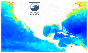
Chlorophyll Concentration
click image for larger view
Shows you where the greenest and bluest water is. Too much chlorophyll means murky water that big visual predator fish avoid. Chlorophyll edges can be places of high productivity, especially near blue water, so big fish can be found near them.
WHY CHOOSE FishCast™
Always Cloud Free
Fathom’s cutting-edge analytics system combines satellite and other real-world data with the industry’s most advanced models to deliver ocean conditions that are cloud free. ALWAYS.
Ultra-High Resolution
FishCast maps have a resolution of 1 km / 0.6 mile. No one offers higher resolution fishing maps. Resolution is important because higher resolution shows finer details when you zoom in.
Hourly Updates
No need to estimate water bodies’ persistence or tendencies. We deliver it every hour. The day before your fishing trip, download all the maps, then view them throughout your trip.
Edges & Hotspots
Temperature edges are shown on our SST maps. Chlorophyll edges are on the Chlorphyll maps. Fishing hotspot intensity is marked in a color scale on our Optimal Catch Location maps.
Nowcast & Forecast
Get today’s ocean conditions and see forecasts of conditions tomorrow and the next day. The forecasts are refreshed every morning to help you decide where – and whether – to fish.
FishCast™ TESTIMONIALS
Fathom Science’s FishCast maps predicted some areas to fish that had incredible results on leg 2 of the Florida West Coast Bluewater Series tournament. A rip that produced the Sailfish, Wahoo, and Dolphin we posted in the tournament.
Being able to see the sea surface temps when it’s cloudy can certainly be a day saver on locating the fish. Either in a big money tournament or just trying to make a charter party happy.
I especially like the reports for SST even when there is significant cloud cover, and of course the availability of maps for different times of the day.
The FishCast™ Guarantee:
Try FishCast and if you don’t like it, cancel any time and receive a refund for your remaining subscription.
FishCast™ SUBSCRIPTION PRICING
Choose a region below to subscribe
Click below on a FishCast™ region to get started!
Fathom Science is run by world-expert oceanographers working on the cutting edge of ocean research and solutions. Fueled by satellite and other real-world data, our proprietary technology delivers the industry’s best information on ocean conditions. FathomScience.com
